
Thank you for supporting this site ❤️
Make a donation
Make a donation
Cipatat topographic map
Click on the map to display elevation.
Thank you for supporting this site ❤️
Make a donation
Make a donation
About this map
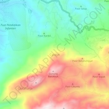
Name: Cipatat topographic map, elevation, terrain.
Location: Cipatat, Bandung Barat, West Java, Java, Indonesia (-6.86333 107.38470 -6.82333 107.42470)
Average elevation: 619 m
Minimum elevation: 382 m
Maximum elevation: 953 m
Thank you for supporting this site ❤️
Make a donation
Make a donation
Other topographic maps
Click on a map to view its topography, its elevation and its terrain.