
Thank you for supporting this site ❤️
Make a donation
Make a donation
Boxanagar topographic map
Click on the map to display elevation.
Thank you for supporting this site ❤️
Make a donation
Make a donation
About this map
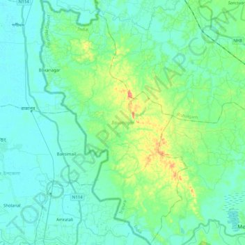
Name: Boxanagar topographic map, elevation, terrain.
Location: Boxanagar, Sonamura, Sipahijala, Tripura, 799106, India (23.48091 91.15947 23.66365 91.27920)
Average elevation: 21 m
Minimum elevation: 4 m
Maximum elevation: 84 m
Thank you for supporting this site ❤️
Make a donation
Make a donation