
Thank you for supporting this site ❤️
Make a donation
Make a donation
Filipstads kommun topographic map
Click on the map to display elevation.
Thank you for supporting this site ❤️
Make a donation
Make a donation
About this map
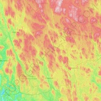
Name: Filipstads kommun topographic map, elevation, terrain.
Location: Filipstads kommun, Värmland County, Sweden (59.55379 13.78066 60.25152 14.46493)
Average elevation: 241 m
Minimum elevation: 50 m
Maximum elevation: 536 m
Thank you for supporting this site ❤️
Make a donation
Make a donation