
Thank you for supporting this site ❤️
Make a donation
Make a donation
Sæbøvik topographic map
Click on the map to display elevation.
Thank you for supporting this site ❤️
Make a donation
Make a donation
About this map
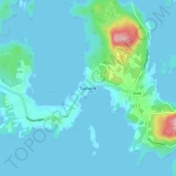
Name: Sæbøvik topographic map, elevation, terrain.
Location: Sæbøvik, Kvinnherad, Вестланн, 5454, Норвегия (59.77419 5.68953 59.81419 5.72953)
Average elevation: 20 m
Minimum elevation: -1 m
Maximum elevation: 184 m
Thank you for supporting this site ❤️
Make a donation
Make a donation
Other topographic maps
Click on a map to view its topography, its elevation and its terrain.