
Thank you for supporting this site ❤️
Make a donation
Make a donation
Aïn Allem topographic map
Click on the map to display elevation.
Thank you for supporting this site ❤️
Make a donation
Make a donation
About this map
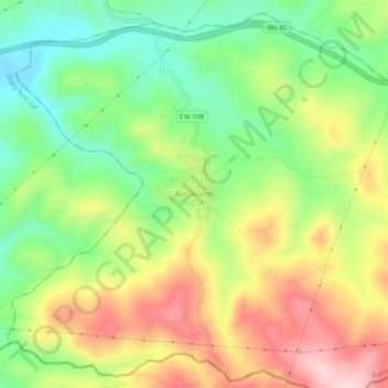
Name: Aïn Allem topographic map, elevation, terrain.
Location: Aïn Allem, Ain Tolba, Daïra Ain Kihal, Aïn Témouchent, Algérie (35.19859 -1.34381 35.23859 -1.30381)
Average elevation: 201 m
Minimum elevation: 82 m
Maximum elevation: 351 m
Thank you for supporting this site ❤️
Make a donation
Make a donation