
Thank you for supporting this site ❤️
Make a donation
Make a donation
Hasslöv topographic map
Click on the map to display elevation.
Thank you for supporting this site ❤️
Make a donation
Make a donation
About this map
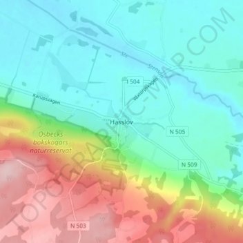
Name: Hasslöv topographic map, elevation, terrain.
Location: Hasslöv, Laholms kommun, Halland County, Sweden (56.39309 12.98607 56.43309 13.02607)
Average elevation: 70 m
Minimum elevation: 2 m
Maximum elevation: 213 m
Thank you for supporting this site ❤️
Make a donation
Make a donation