
Thank you for supporting this site ❤️
Make a donation
Make a donation
Fjallið topographic map
Click on the map to display elevation.
Thank you for supporting this site ❤️
Make a donation
Make a donation
About this map
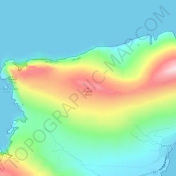
Name: Fjallið topographic map, elevation, terrain.
Location: Fjallið, Sandvík, Suðuroyar sýsla, 860, Færøerne (61.64171 -6.95448 61.64181 -6.95438)
Average elevation: 109 m
Minimum elevation: -7 m
Maximum elevation: 397 m
Thank you for supporting this site ❤️
Make a donation
Make a donation