
Thank you for supporting this site ❤️
Make a donation
Make a donation
Söderby topographic map
Click on the map to display elevation.
Thank you for supporting this site ❤️
Make a donation
Make a donation
About this map
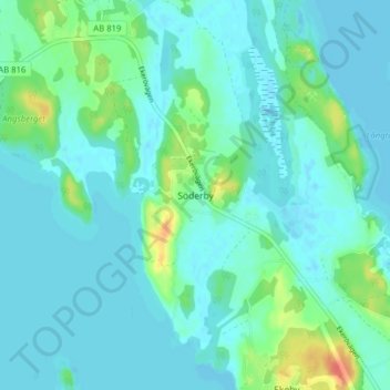
Name: Söderby topographic map, elevation, terrain.
Location: Söderby, Ekerö kommun, Stockholms län, Sverige (59.36242 17.56030 59.40242 17.60030)
Average elevation: 9 m
Minimum elevation: -2 m
Maximum elevation: 46 m
Thank you for supporting this site ❤️
Make a donation
Make a donation
Other topographic maps
Click on a map to view its topography, its elevation and its terrain.