
Thank you for supporting this site ❤️
Make a donation
Make a donation
Åled topographic map
Click on the map to display elevation.
Thank you for supporting this site ❤️
Make a donation
Make a donation
About this map
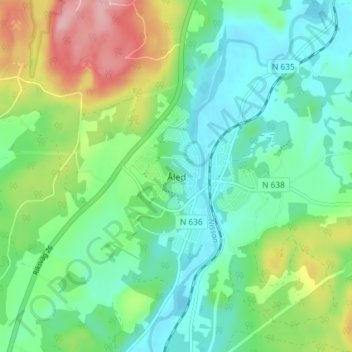
Name: Åled topographic map, elevation, terrain.
Location: Åled, Halmstads kommun, Halland County, 313 50, Sweden (56.72396 12.92228 56.76396 12.96228)
Average elevation: 53 m
Minimum elevation: 6 m
Maximum elevation: 159 m
Thank you for supporting this site ❤️
Make a donation
Make a donation
Other topographic maps
Click on a map to view its topography, its elevation and its terrain.
Thank you for supporting this site ❤️
Make a donation
Make a donation
Thank you for supporting this site ❤️
Make a donation
Make a donation