
Thank you for supporting this site ❤️
Make a donation
Make a donation
Vágar topographic map
Click on the map to display elevation.
Thank you for supporting this site ❤️
Make a donation
Make a donation
About this map
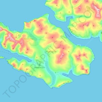
Name: Vágar topographic map, elevation, terrain.
Location: Vágar, Vágar region, Faroe Islands (62.02008 -7.46502 62.15971 -7.06015)
Average elevation: 141 m
Minimum elevation: -1 m
Maximum elevation: 738 m
Thank you for supporting this site ❤️
Make a donation
Make a donation