
Thank you for supporting this site ❤️
Make a donation
Make a donation
Älvkarleby topographic map
Click on the map to display elevation.
Thank you for supporting this site ❤️
Make a donation
Make a donation
About this map
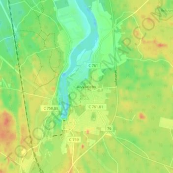
Name: Älvkarleby topographic map, elevation, terrain.
Location: Älvkarleby, Älvkarleby kommun, Uppsala County, 814 70, Sweden (60.55133 17.43250 60.59133 17.47250)
Average elevation: 19 m
Minimum elevation: -2 m
Maximum elevation: 38 m
Thank you for supporting this site ❤️
Make a donation
Make a donation
Other topographic maps
Click on a map to view its topography, its elevation and its terrain.
Thank you for supporting this site ❤️
Make a donation
Make a donation
Thank you for supporting this site ❤️
Make a donation
Make a donation