
Thank you for supporting this site ❤️
Make a donation
Make a donation
El Chaltén topographic map
Click on the map to display elevation.
Thank you for supporting this site ❤️
Make a donation
Make a donation
About this map
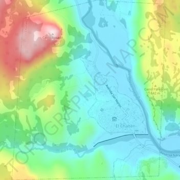
Name: El Chaltén topographic map, elevation, terrain.
Location: El Chaltén, Lago Argentino, Santa Cruz Province, Argentina (-49.34211 -72.91594 -49.31116 -72.87518)
Average elevation: 524 m
Minimum elevation: 387 m
Maximum elevation: 838 m
Thank you for supporting this site ❤️
Make a donation
Make a donation