
Thank you for supporting this site ❤️
Make a donation
Make a donation
Volcán Zapatera topographic map
Click on the map to display elevation.
Thank you for supporting this site ❤️
Make a donation
Make a donation
About this map
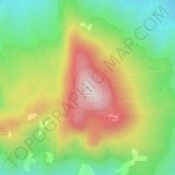
Name: Volcán Zapatera topographic map, elevation, terrain.
Location: Volcán Zapatera, Granada, 43000, Nicaragua (11.73790 -85.81662 11.73800 -85.81652)
Average elevation: 356 m
Minimum elevation: 122 m
Maximum elevation: 611 m
Thank you for supporting this site ❤️
Make a donation
Make a donation
Other topographic maps
Click on a map to view its topography, its elevation and its terrain.