
Thank you for supporting this site ❤️
Make a donation
Make a donation
Hæddin topographic map
Click on the map to display elevation.
Thank you for supporting this site ❤️
Make a donation
Make a donation
About this map
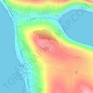
Name: Hæddin topographic map, elevation, terrain.
Location: Hæddin, Lamba, Eysturoyar sýsla, 627, Færøerne (62.13347 -6.71143 62.13357 -6.71133)
Average elevation: 105 m
Minimum elevation: -24 m
Maximum elevation: 299 m
Thank you for supporting this site ❤️
Make a donation
Make a donation