
Thank you for supporting this site ❤️
Make a donation
Make a donation
Rodewisch topographic map
Click on the map to display elevation.
Thank you for supporting this site ❤️
Make a donation
Make a donation
About this map
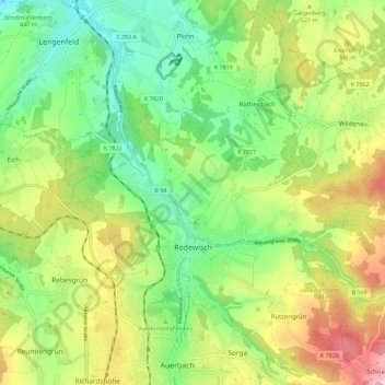
Name: Rodewisch topographic map, elevation, terrain.
Location: Rodewisch, Vogtlandkreis, Saxony, 08228, Germany (50.50501 12.36481 50.57706 12.47116)
Average elevation: 490 m
Minimum elevation: 360 m
Maximum elevation: 698 m
Thank you for supporting this site ❤️
Make a donation
Make a donation
Other topographic maps
Click on a map to view its topography, its elevation and its terrain.