
Thank you for supporting this site ❤️
Make a donation
Make a donation
Simandou topographic map
Click on the map to display elevation.
Thank you for supporting this site ❤️
Make a donation
Make a donation
About this map
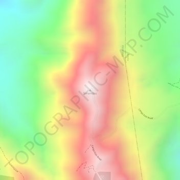
Name: Simandou topographic map, elevation, terrain.
Location: Simandou, Macenta Prefecture, Nzérékoré Region, Guinea (8.55431 -8.90722 8.55441 -8.90712)
Average elevation: 1,206 m
Minimum elevation: 769 m
Maximum elevation: 1,618 m
Thank you for supporting this site ❤️
Make a donation
Make a donation
Other topographic maps
Click on a map to view its topography, its elevation and its terrain.