
Thank you for supporting this site ❤️
Make a donation
Make a donation
Rimbach topographic map
Click on the map to display elevation.
Thank you for supporting this site ❤️
Make a donation
Make a donation
About this map
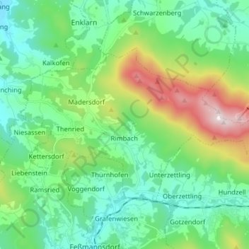
Name: Rimbach topographic map, elevation, terrain.
Location: Rimbach, Landkreis Cham, Bavaria, 93485, Germany (49.20692 12.83078 49.25886 12.95898)
Average elevation: 564 m
Minimum elevation: 383 m
Maximum elevation: 1,074 m
Thank you for supporting this site ❤️
Make a donation
Make a donation
Other topographic maps
Click on a map to view its topography, its elevation and its terrain.