
Thank you for supporting this site ❤️
Make a donation
Make a donation
Støðlafjall topographic map
Click on the map to display elevation.
Thank you for supporting this site ❤️
Make a donation
Make a donation
About this map
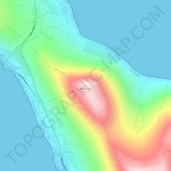
Name: Støðlafjall topographic map, elevation, terrain.
Location: Støðlafjall, Syðrugøta, Eysturoyar sýsla, 513, Færøerne (62.17042 -6.74602 62.17052 -6.74592)
Average elevation: 137 m
Minimum elevation: -1 m
Maximum elevation: 515 m
Thank you for supporting this site ❤️
Make a donation
Make a donation