
Thank you for supporting this site ❤️
Make a donation
Make a donation
Múlatindur topographic map
Click on the map to display elevation.
Thank you for supporting this site ❤️
Make a donation
Make a donation
About this map
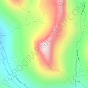
Name: Múlatindur topographic map, elevation, terrain.
Location: Múlatindur, Funningsfjørður, Eysturoyar sýsla, 477, Færøerne (62.23530 -6.90270 62.23540 -6.90260)
Average elevation: 321 m
Minimum elevation: 4 m
Maximum elevation: 767 m
Thank you for supporting this site ❤️
Make a donation
Make a donation