
Thank you for supporting this site ❤️
Make a donation
Make a donation
Fjallið topographic map
Click on the map to display elevation.
Thank you for supporting this site ❤️
Make a donation
Make a donation
About this map
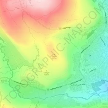
Name: Fjallið topographic map, elevation, terrain.
Location: Fjallið, Thorshavn, Streymoyar sýsla, 100, Færøerne (62.00764 -6.81571 62.00774 -6.81561)
Average elevation: 164 m
Minimum elevation: 29 m
Maximum elevation: 335 m
Thank you for supporting this site ❤️
Make a donation
Make a donation