
Make a donation
La Magdalena Contreras topographic map
Click on the map to display elevation.
Make a donation
La Magdalena Contreras
La Magdalena Contreras (Spanish pronunciation: [maɣðaˈlena konˈtɾeɾas] ) is a borough (demarcación territorial) in the Mexico City. As of the 2010 census, it has a population of 239,086 inhabitants and is the third-least populous of Mexico City's boroughs. It lies at an elevation of 2,365 m (7,759 ft) above sea level. It is named after two historically important communities—La Magdalena Atlitic and Colonia Contreras. The northern end of the borough is urbanized. The rest of Magdalena Contreras, with its mountains and ravines, is designated as a conservation zone. However, urban sprawl has put pressure on these conservation areas. In an effort to preserve the area's forests and natural resources, the borough government has started promoting ecotourism.
Make a donation
About this map
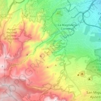
Name: La Magdalena Contreras topographic map, elevation, terrain.
Location: La Magdalena Contreras, Mexico City, Mexico (19.21306 -99.32331 19.33791 -99.20663)
Average elevation: 2,828 m
Minimum elevation: 2,259 m
Maximum elevation: 3,855 m
Make a donation
Other topographic maps
Click on a map to view its topography, its elevation and its terrain.