
Thank you for supporting this site ❤️
Make a donation
Make a donation
Province of Carabaya topographic map
Click on the map to display elevation.
Thank you for supporting this site ❤️
Make a donation
Make a donation
About this map
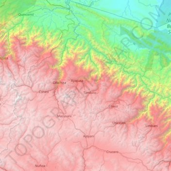
Name: Province of Carabaya topographic map, elevation, terrain.
Location: Province of Carabaya, Puno, Peru (-14.51782 -70.88134 -13.11441 -69.63269)
Average elevation: 2,945 m
Minimum elevation: 201 m
Maximum elevation: 5,784 m
Thank you for supporting this site ❤️
Make a donation
Make a donation