
Thank you for supporting this site ❤️
Make a donation
Make a donation
Rybnik topographic map
Click on the map to display elevation.
Thank you for supporting this site ❤️
Make a donation
Make a donation
About this map
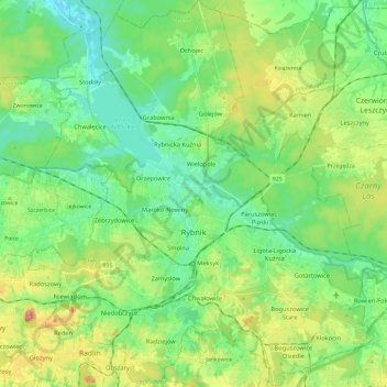
Name: Rybnik topographic map, elevation, terrain.
Location: Rybnik, Silesian Voivodeship, Poland (50.03537 18.44168 50.18567 18.65684)
Average elevation: 252 m
Minimum elevation: 202 m
Maximum elevation: 369 m
Thank you for supporting this site ❤️
Make a donation
Make a donation
Other topographic maps
Click on a map to view its topography, its elevation and its terrain.
Thank you for supporting this site ❤️
Make a donation
Make a donation
Thank you for supporting this site ❤️
Make a donation
Make a donation