
Thank you for supporting this site ❤️
Make a donation
Make a donation
Karadiğin topographic map
Click on the map to display elevation.
Thank you for supporting this site ❤️
Make a donation
Make a donation
About this map
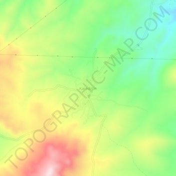
Name: Karadiğin topographic map, elevation, terrain.
Location: Karadiğin, Meram, Konya, Central Anatolia Region, Turkey (37.70695 32.31654 37.74695 32.35654)
Average elevation: 1,384 m
Minimum elevation: 1,217 m
Maximum elevation: 1,596 m
Thank you for supporting this site ❤️
Make a donation
Make a donation
Other topographic maps
Click on a map to view its topography, its elevation and its terrain.