
Thank you for supporting this site ❤️
Make a donation
Make a donation
Hørning topographic map
Click on the map to display elevation.
Thank you for supporting this site ❤️
Make a donation
Make a donation
About this map
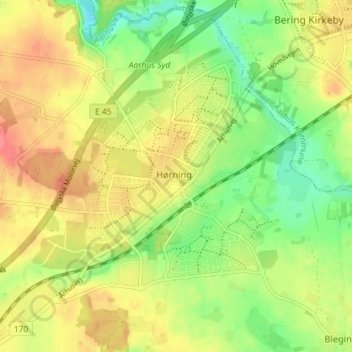
Name: Hørning topographic map, elevation, terrain.
Location: Hørning, Skanderborg Municipality, 8362, Denmark (56.06567 10.01612 56.10567 10.05612)
Average elevation: 62 m
Minimum elevation: 31 m
Maximum elevation: 91 m
Thank you for supporting this site ❤️
Make a donation
Make a donation