
Thank you for supporting this site ❤️
Make a donation
Make a donation
Lómfelli topographic map
Click on the map to display elevation.
Thank you for supporting this site ❤️
Make a donation
Make a donation
About this map
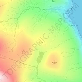
Name: Lómfelli topographic map, elevation, terrain.
Location: Lómfelli, Haldórsvík, Streymoyar sýsla, 440, Færøerne (62.26630 -7.11207 62.26640 -7.11197)
Average elevation: 274 m
Minimum elevation: 0 m
Maximum elevation: 606 m
Thank you for supporting this site ❤️
Make a donation
Make a donation