
Thank you for supporting this site ❤️
Make a donation
Make a donation
StiðjafjalI topographic map
Click on the map to display elevation.
Thank you for supporting this site ❤️
Make a donation
Make a donation
About this map
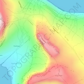
Name: StiðjafjalI topographic map, elevation, terrain.
Location: StiðjafjalI, Sund, Streymoyar sýsla, 186, Færøerne (62.04691 -6.90914 62.04701 -6.90904)
Average elevation: 267 m
Minimum elevation: 0 m
Maximum elevation: 605 m
Thank you for supporting this site ❤️
Make a donation
Make a donation