
Thank you for supporting this site ❤️
Make a donation
Make a donation
Zawiercie topographic map
Click on the map to display elevation.
Thank you for supporting this site ❤️
Make a donation
Make a donation
About this map
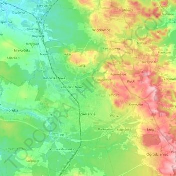
Name: Zawiercie topographic map, elevation, terrain.
Location: Zawiercie, Zawiercie County, Silesian Voivodeship, Poland (50.45683 19.35933 50.55440 19.58153)
Average elevation: 353 m
Minimum elevation: 291 m
Maximum elevation: 461 m
Thank you for supporting this site ❤️
Make a donation
Make a donation
Other topographic maps
Click on a map to view its topography, its elevation and its terrain.