
Provo topographic map
Interactive map
Click on the map to display elevation.
About this map
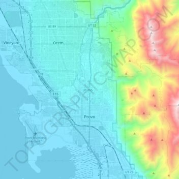
Name: Provo topographic map, elevation, terrain.
Location: Provo, Utah County, Utah, United States (40.18580 -111.74096 40.32880 -111.53687)
Average elevation: 1,728 m
Minimum elevation: 1,364 m
Maximum elevation: 3,356 m
Provo lies in the Utah Valley at an elevation of 4,549 feet (1,387 m). According to the United States Census Bureau, the city has a total area of 44.2 square miles (114.4 km2), of which 41.7 square miles (107.9 km2) is land and 2.5 square miles (6.5 km2), or 5.66%, is water.