
Thank you for supporting this site ❤️
Make a donation
Make a donation
Águas Boas topographic map
Click on the map to display elevation.
Thank you for supporting this site ❤️
Make a donation
Make a donation
About this map
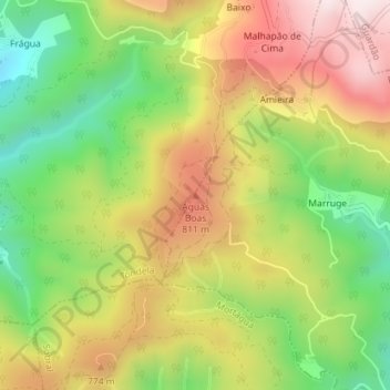
Name: Águas Boas topographic map, elevation, terrain.
Location: Águas Boas, Tondela, Viseu, 3465-195, Portugal (40.52275 -8.22815 40.52285 -8.22805)
Average elevation: 643 m
Minimum elevation: 351 m
Maximum elevation: 954 m
Thank you for supporting this site ❤️
Make a donation
Make a donation
Other topographic maps
Click on a map to view its topography, its elevation and its terrain.