
Thank you for supporting this site ❤️
Make a donation
Make a donation
Mont Éléphant topographic map
Click on the map to display elevation.
Thank you for supporting this site ❤️
Make a donation
Make a donation
About this map
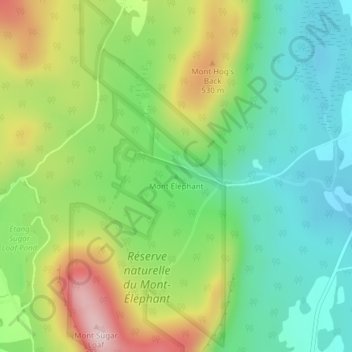
Name: Mont Éléphant topographic map, elevation, terrain.
Location: Mont Éléphant, Potton, Memphrémagog, Estrie, Quebec, Canada (45.12900 -72.31599 45.12910 -72.31589)
Average elevation: 389 m
Minimum elevation: 246 m
Maximum elevation: 637 m
Thank you for supporting this site ❤️
Make a donation
Make a donation