
Thank you for supporting this site ❤️
Make a donation
Make a donation
La Corniche topographic map
Click on the map to display elevation.
Thank you for supporting this site ❤️
Make a donation
Make a donation
About this map
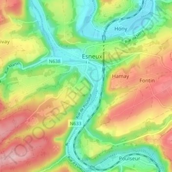
Name: La Corniche topographic map, elevation, terrain.
Location: La Corniche, Esneux, Liège, Wallonia, 4130, Belgium (50.50664 5.54637 50.54664 5.58637)
Average elevation: 156 m
Minimum elevation: 74 m
Maximum elevation: 264 m
Thank you for supporting this site ❤️
Make a donation
Make a donation
Other topographic maps
Click on a map to view its topography, its elevation and its terrain.