
Saint Barthélemy topographic map
Interactive map
Click on the map to display elevation.
Saint Barthélemy
Morne de Vitet, 286 metres (938 feet) in height, is the highest peak on the island. Hills and valleys of varying topography cover the rest of the island. Notable are Morne Rouge, Morne Criquet, Morne de Grand Fond, Morne de Dépoudré and Morne Lurin. The largest bodies of water on the island are Étang de Saint-Jean, Grande Saline, Grand Étang, and Petit Étang.
About this map
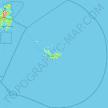
Name: Saint Barthélemy topographic map, elevation, terrain.
Location: Saint Barthélemy, 97133, France (17.67093 -63.06639 18.13756 -62.58440)
Average elevation: 2 m
Minimum elevation: -2 m
Maximum elevation: 407 m
Other topographic maps
Click on a map to view its topography, its elevation and its terrain.
Val Thorens
France > Auvergne-Rhône-Alpes > Savoy
Val Thorens ([val tɔʁɑ̃]) is a ski town in the Tarentaise Valley in the French Alps at an altitude of 2,300 m (7,500 ft). It is located in the commune of Saint-Martin-de-Belleville in the Savoie department. The resort forms part of the Les Trois Vallées ski area which, with over 600 km of slopes, is one…
Average elevation: 2,516 m
Laudibertie
France > Nouvelle-Aquitaine > Dordogne > Saint-Privat-en-Périgord > Festalemps
Average elevation: 93 m
Lavillemichel
France > Nouvelle-Aquitaine > Haute-Vienne > Bessines-sur-Gartempe
Average elevation: 349 m
Beauregard
France > Bourgogne – Franche-Comté > Nièvre > Saint-Amand-en-Puisaye
Average elevation: 220 m
La Fageole
France > Nouvelle-Aquitaine > Dordogne > Saint-Félix-de-Reillac-et-Mortemart
Average elevation: 213 m
Les Gardes
France > Auvergne-Rhône-Alpes > Cantal > Saint-Jacques-des-Blats
Average elevation: 1,266 m
Le Balestier
France > New Aquitaine > Coux et Bigaroque-Mouzens > Le Balestier
Average elevation: 171 m
La Madone de Fenestre
France > Provence-Alpes-Côte d'Azur > Saint-Martin-Vésubie > La Madone de Fenestre
Average elevation: 2,202 m
Paris
Paris in its early history had only the rivers Seine and Bièvre for water. From 1809, the Canal de l'Ourcq provided Paris with water from less-polluted rivers to the north-east of the capital. From 1857, the civil engineer Eugène Belgrand, under Napoleon III, oversaw the construction of a series of new…
Average elevation: 75 m