
Thank you for supporting this site ❤️
Make a donation
Make a donation
Aydoğan topographic map
Click on the map to display elevation.
Thank you for supporting this site ❤️
Make a donation
Make a donation
About this map
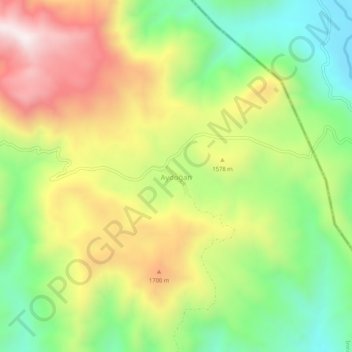
Name: Aydoğan topographic map, elevation, terrain.
Location: Aydoğan, İmranlı, Sivas, Central Anatolia Region, Turkey (39.58165 38.28629 39.62165 38.32629)
Average elevation: 1,508 m
Minimum elevation: 1,156 m
Maximum elevation: 1,942 m
Thank you for supporting this site ❤️
Make a donation
Make a donation