
Thank you for supporting this site ❤️
Make a donation
Make a donation
Markneukirchen topographic map
Click on the map to display elevation.
Thank you for supporting this site ❤️
Make a donation
Make a donation
About this map
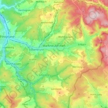
Name: Markneukirchen topographic map, elevation, terrain.
Location: Markneukirchen, Vogtlandkreis, Saxony, Germany (50.25354 12.27510 50.35413 12.43740)
Average elevation: 583 m
Minimum elevation: 432 m
Maximum elevation: 803 m
Thank you for supporting this site ❤️
Make a donation
Make a donation
Other topographic maps
Click on a map to view its topography, its elevation and its terrain.