
Thank you for supporting this site ❤️
Make a donation
Make a donation
Mugeba topographic map
Click on the map to display elevation.
Thank you for supporting this site ❤️
Make a donation
Make a donation
About this map
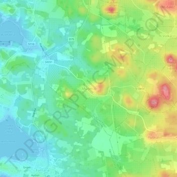
Name: Mugeba topographic map, elevation, terrain.
Location: Mugeba, Grad Poreč, Istria County, 52452, Croatia (45.17305 13.60009 45.21305 13.64009)
Average elevation: 35 m
Minimum elevation: -2 m
Maximum elevation: 103 m
Thank you for supporting this site ❤️
Make a donation
Make a donation
Other topographic maps
Click on a map to view its topography, its elevation and its terrain.