
Thank you for supporting this site ❤️
Make a donation
Make a donation
Trysil topographic map
Click on the map to display elevation.
Thank you for supporting this site ❤️
Make a donation
Make a donation
About this map
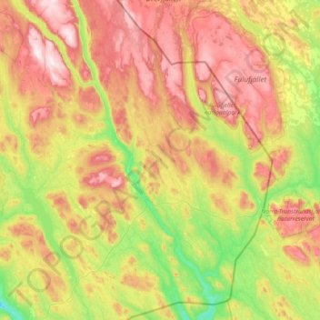
Name: Trysil topographic map, elevation, terrain.
Location: Trysil, Innlandet, Norway (61.01308 11.73716 61.69914 12.87086)
Average elevation: 631 m
Minimum elevation: 282 m
Maximum elevation: 1,199 m
Thank you for supporting this site ❤️
Make a donation
Make a donation
Other topographic maps
Click on a map to view its topography, its elevation and its terrain.