
Thank you for supporting this site ❤️
Make a donation
Make a donation
Uppi á Manni topographic map
Click on the map to display elevation.
Thank you for supporting this site ❤️
Make a donation
Make a donation
About this map
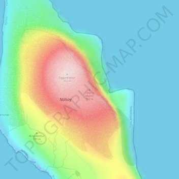
Name: Uppi á Manni topographic map, elevation, terrain.
Location: Uppi á Manni, Nólsoy, Streymoyar sýsla, 270, Færøerne (61.98685 -6.64552 61.98695 -6.64542)
Average elevation: 103 m
Minimum elevation: -31 m
Maximum elevation: 362 m
Thank you for supporting this site ❤️
Make a donation
Make a donation