
Thank you for supporting this site ❤️
Make a donation
Make a donation
Mýlingur topographic map
Click on the map to display elevation.
Thank you for supporting this site ❤️
Make a donation
Make a donation
About this map
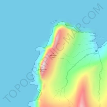
Name: Mýlingur topographic map, elevation, terrain.
Location: Mýlingur, Tjørnuvík, Streymoyar sýsla, 445, Færøerne (62.29657 -7.21798 62.29667 -7.21788)
Average elevation: 131 m
Minimum elevation: -3 m
Maximum elevation: 646 m
Thank you for supporting this site ❤️
Make a donation
Make a donation