
Thank you for supporting this site ❤️
Make a donation
Make a donation
Eggjarmúli topographic map
Click on the map to display elevation.
Thank you for supporting this site ❤️
Make a donation
Make a donation
About this map
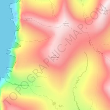
Name: Eggjarmúli topographic map, elevation, terrain.
Location: Eggjarmúli, Saksun, Streymoyar sýsla, 436, Færøerne (62.27178 -7.20774 62.27188 -7.20764)
Average elevation: 413 m
Minimum elevation: -17 m
Maximum elevation: 676 m
Thank you for supporting this site ❤️
Make a donation
Make a donation