
Thank you for supporting this site ❤️
Make a donation
Make a donation
Izsák topographic map
Click on the map to display elevation.
Thank you for supporting this site ❤️
Make a donation
Make a donation
About this map
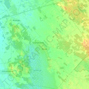
Name: Izsák topographic map, elevation, terrain.
Average elevation: 101 m
Minimum elevation: 92 m
Maximum elevation: 117 m
Thank you for supporting this site ❤️
Make a donation
Make a donation
Other topographic maps
Click on a map to view its topography, its elevation and its terrain.
Nationalpark Kleinkumanien
Das 1992 ha große Schutzgebiet ist ein vorrangiges Schutzgebiet, welches seit Gründung des Nationalparks im Jahr 1975 geschützt wird. Es besteht aus Treibsandzonen des Kiskunság-Sandrückens die mit Wanderdünen bedeckt sind. Die Höhe der Dünen variiert zwischen 117 m und 130 m. Der größte Teil der…
Average elevation: 97 m