
Thank you for supporting this site ❤️
Make a donation
Make a donation
Clavières topographic map
Click on the map to display elevation.
Thank you for supporting this site ❤️
Make a donation
Make a donation
About this map
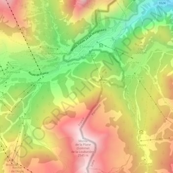
Name: Clavières topographic map, elevation, terrain.
Location: Clavières, Turin, Piémont, Italie (44.91332 6.74366 44.94807 6.76563)
Average elevation: 2,032 m
Minimum elevation: 1,495 m
Maximum elevation: 2,537 m
Thank you for supporting this site ❤️
Make a donation
Make a donation
Other topographic maps
Click on a map to view its topography, its elevation and its terrain.