
Thank you for supporting this site ❤️
Make a donation
Make a donation
Lycksele topographic map
Click on the map to display elevation.
Thank you for supporting this site ❤️
Make a donation
Make a donation
About this map
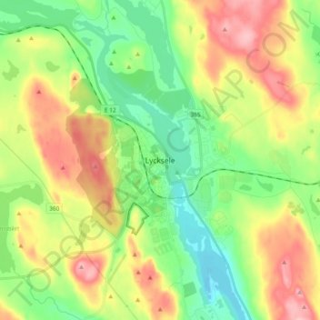
Name: Lycksele topographic map, elevation, terrain.
Location: Lycksele, Lycksele kommun, Västerbotten County, 921 31, Sweden (64.55586 18.63776 64.63586 18.71776)
Average elevation: 251 m
Minimum elevation: 193 m
Maximum elevation: 336 m
Thank you for supporting this site ❤️
Make a donation
Make a donation
Other topographic maps
Click on a map to view its topography, its elevation and its terrain.