
Thank you for supporting this site ❤️
Make a donation
Make a donation
González topographic map
Click on the map to display elevation.
Thank you for supporting this site ❤️
Make a donation
Make a donation
About this map
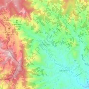
Name: González topographic map, elevation, terrain.
Location: González, Cesar, Colombia (8.37129 -73.40154 8.41129 -73.36154)
Average elevation: 1,414 m
Minimum elevation: 1,215 m
Maximum elevation: 1,665 m
Thank you for supporting this site ❤️
Make a donation
Make a donation