
Thank you for supporting this site ❤️
Make a donation
Make a donation
Salthøvdi topographic map
Click on the map to display elevation.
Thank you for supporting this site ❤️
Make a donation
Make a donation
About this map
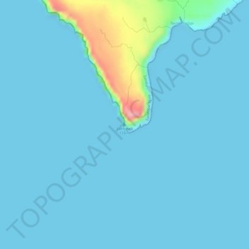
Name: Salthøvdi topographic map, elevation, terrain.
Location: Salthøvdi, Sandur, Sandoyar sýsla, 210, Færøerne (61.82001 -6.87705 61.82011 -6.87695)
Average elevation: 11 m
Minimum elevation: -1 m
Maximum elevation: 121 m
Thank you for supporting this site ❤️
Make a donation
Make a donation