
Thank you for supporting this site ❤️
Make a donation
Make a donation
Fjallið Mikla topographic map
Click on the map to display elevation.
Thank you for supporting this site ❤️
Make a donation
Make a donation
About this map
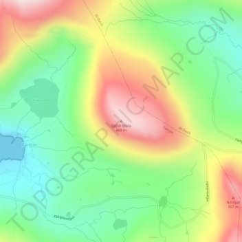
Name: Fjallið Mikla topographic map, elevation, terrain.
Location: Fjallið Mikla, Fámjin, Suðuroyar sýsla, 870, Færøerne (61.52740 -6.85724 61.52750 -6.85714)
Average elevation: 196 m
Minimum elevation: 0 m
Maximum elevation: 477 m
Thank you for supporting this site ❤️
Make a donation
Make a donation