
Thank you for supporting this site ❤️
Make a donation
Make a donation
El Retiro topographic map
Click on the map to display elevation.
Thank you for supporting this site ❤️
Make a donation
Make a donation
About this map
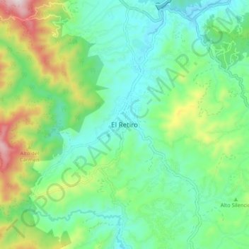
Name: El Retiro topographic map, elevation, terrain.
Location: El Retiro, Retiro, Oriente, Antioquia, 055437, Colombia (6.01727 -75.54261 6.09727 -75.46261)
Average elevation: 2,310 m
Minimum elevation: 2,116 m
Maximum elevation: 2,800 m
Thank you for supporting this site ❤️
Make a donation
Make a donation