
Thank you for supporting this site ❤️
Make a donation
Make a donation
Hammenhög topographic map
Click on the map to display elevation.
Thank you for supporting this site ❤️
Make a donation
Make a donation
About this map
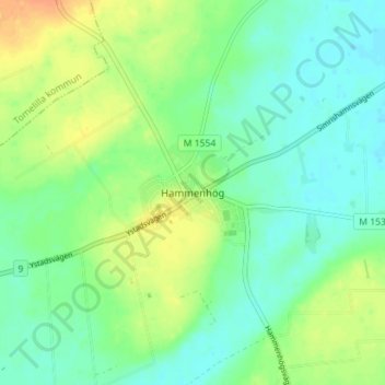
Name: Hammenhög topographic map, elevation, terrain.
Location: Hammenhög, Simrishamns kommun, Skåne län, 276 50, Zweden (55.48325 14.13214 55.52325 14.17214)
Average elevation: 52 m
Minimum elevation: 39 m
Maximum elevation: 75 m
Thank you for supporting this site ❤️
Make a donation
Make a donation
Other topographic maps
Click on a map to view its topography, its elevation and its terrain.
Thank you for supporting this site ❤️
Make a donation
Make a donation
Thank you for supporting this site ❤️
Make a donation
Make a donation