
Thank you for supporting this site ❤️
Make a donation
Make a donation
Vent topographic map
Click on the map to display elevation.
Thank you for supporting this site ❤️
Make a donation
Make a donation
About this map
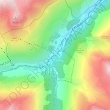
Name: Vent topographic map, elevation, terrain.
Location: Vent, Sölden, Bezirk Imst, 6458, Austria (46.84001 10.89467 46.88001 10.93467)
Average elevation: 2,371 m
Minimum elevation: 1,816 m
Maximum elevation: 3,098 m
Thank you for supporting this site ❤️
Make a donation
Make a donation