
Thank you for supporting this site ❤️
Make a donation
Make a donation
Cargèse topographic map
Click on the map to display elevation.
Thank you for supporting this site ❤️
Make a donation
Make a donation
Cargèse
Son territoire est la terminaison en mer, à la punta Cargèse, d'un chaînon secondaire articulé à la pointe de Cricche (2 053 m d'altitude, sommet « à cheval » sur Ota et Albertacce) sur la chaîne principale de l'île, une ligne où s'élèvent les plus hauts sommets qui constituent une véritable barrière entre les deux départements actuels.
Thank you for supporting this site ❤️
Make a donation
Make a donation
About this map
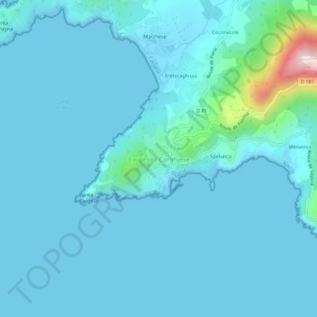
Name: Cargèse topographic map, elevation, terrain.
Average elevation: 32 m
Minimum elevation: -2 m
Maximum elevation: 394 m
Thank you for supporting this site ❤️
Make a donation
Make a donation
Other topographic maps
Click on a map to view its topography, its elevation and its terrain.